
One Saturday afternoon last summer, Carrie and Jason Guyette were married on an island on the Vermont side of Lake Champlain. The forecast had been good—partly cloudy, a west wind of 5 to 10 miles per hour—but the weather was even better. The sky was cloudless, the light falling across the lake in rays of silver and blue. "It was the perfect day for a wedding," recalls Suzanne LaBombard, the mother of the bride.
After the newlyweds kissed, the weather began to change. "The wind shifted round to the north and began to pick up," says Jason, "but it wasn't really anything to worry about." The bride and groom climbed into an open carriage for a tour of the island, but after a while the wind was strong enough for the bride to start worrying about her veil, and the driver about her horses. They turned back. "I could see the distinct edge of the front—it looked about two miles (three kilometers) south," says Jason.
They returned to the tent, where most of the 200 guests had gathered for the reception. The flaps were whipping, and one or two small pegs were uprooted, but even so, there seemed no reason to worry. The tent, 60 feet by 120 feet (18 meters by 37 meters) in size, was anchored by stakes driven four feet (1.2 meters) into the ground. "This thing's not going anywhere," the DJ told Jason.
The groom turned, took four paces, and heard a ferocious whoosh behind him. A single devastating gust ripped the tent out of the ground and lifted it over his head. Six-foot (two-meter) stakes flew through the air like javelins. China and glass shattered. A 30-foot (9-meter) main pole swept across the lawn as the family and guests ducked or flung themselves to the ground.
The gust, which lasted just seconds, had the freakish capriciousness of a tornado. It slammed the tent back down so hard that stakes were driven into the earth again. "It was so fast it was uncanny," Jason says. Seven people were hurt by flying stakes and glass. The groom's step-grandmother was rushed to a hospital in Burlington, where she died of her injuries.
Weather moves on a grand scale, in fronts and storms that can span half a continent. But it is also intensely personal and extremely local. The brilliant weather at the wedding, the terrifying storm at the reception—this is weather on the scale that matters to us. So we demand of meteorologists the near impossible: Understand the drama of the entire planet's atmosphere, and tell us what to expect here. Today. At 4:30 p.m.
Thanks mainly to keener instruments and more powerful computers, forecasters are extending their reach into the uncertain future. These days a forecast of the daily high temperature five days in advance is likely to be about five degrees off in the United States, two degrees better than in 1975. Flash flood warnings have improved from 7 minutes in 1987 to 47 minutes in 2004. Had last summer's barrage of hurricanes along the Gulf Coast and Florida struck 30 years ago, landfall predictions three days ahead could have been off by as much as 475 miles (764 kilometers). By last year the average error had been cut by nearly 300 miles (483 kilometers), allowing more selective evacuations.
Yet because the tiniest changes in the atmosphere can produce radical changes in weather, the perfect forecast is tantalizingly elusive. We may never be able to anticipate a hurricane's every move. And the smallest, fastest changing weather events, like that wedding-day storm, may always be capable of blindsiding us.
"Forecasting is still an inexact science," says Charles McGill, who works in the Burlington office of NOAA's National Weather Service (NWS). A day before the wedding, the office had predicted storms for late in the evening, but not for that afternoon. "Maybe someday the forecast models will be good enough to pinpoint when and where individual thunderstorms will occur, but I think that day is a long way away."
All it takes to create weather is air and solar heating. Then things get complicated. Some of the sun's energy is reflected by clouds; some heats land masses and oceans. Air warmed in the tropics becomes less dense, rises, and heads toward the Poles. Along the way it cools, its freight of moisture condensing into clouds and falling as precipitation. Earth's rotation causes the air currents to swerve right in the Northern Hemisphere and left in the Southern. Mountain ranges, ocean currents, and the high-altitude jet streams meandering around the globe at 200 miles per hour or more all shape the broad circulation pattern. Add local variations in temperature, humidity, and pressure, and the result is the weather we feel on the cheek or read in the clouds.
Much of the physics involved has been understood for decades, even centuries. Yet those forces combine in so many ways, obeying so many variables, that weather is like a summer cumulus: Its stately progress across the sky seems entirely predictable, but each wisp and tentacle seems to have a life of its own, erratic and seemingly random.
Prediction efforts began where they were most needed. In 17th-century Britain, for example, Edmond Halley of comet fame mapped the trade winds and the Asian monsoon as an aid to sailors. Typhoon-prone Japan has a mountainous landscape that crowds its people and industry near the coasts, where they are vulnerable to landslides and storm surges. As a result the Japan Meteorological Agency has become a leader in forecasting typhoons in the western North Pacific and the South China Sea.
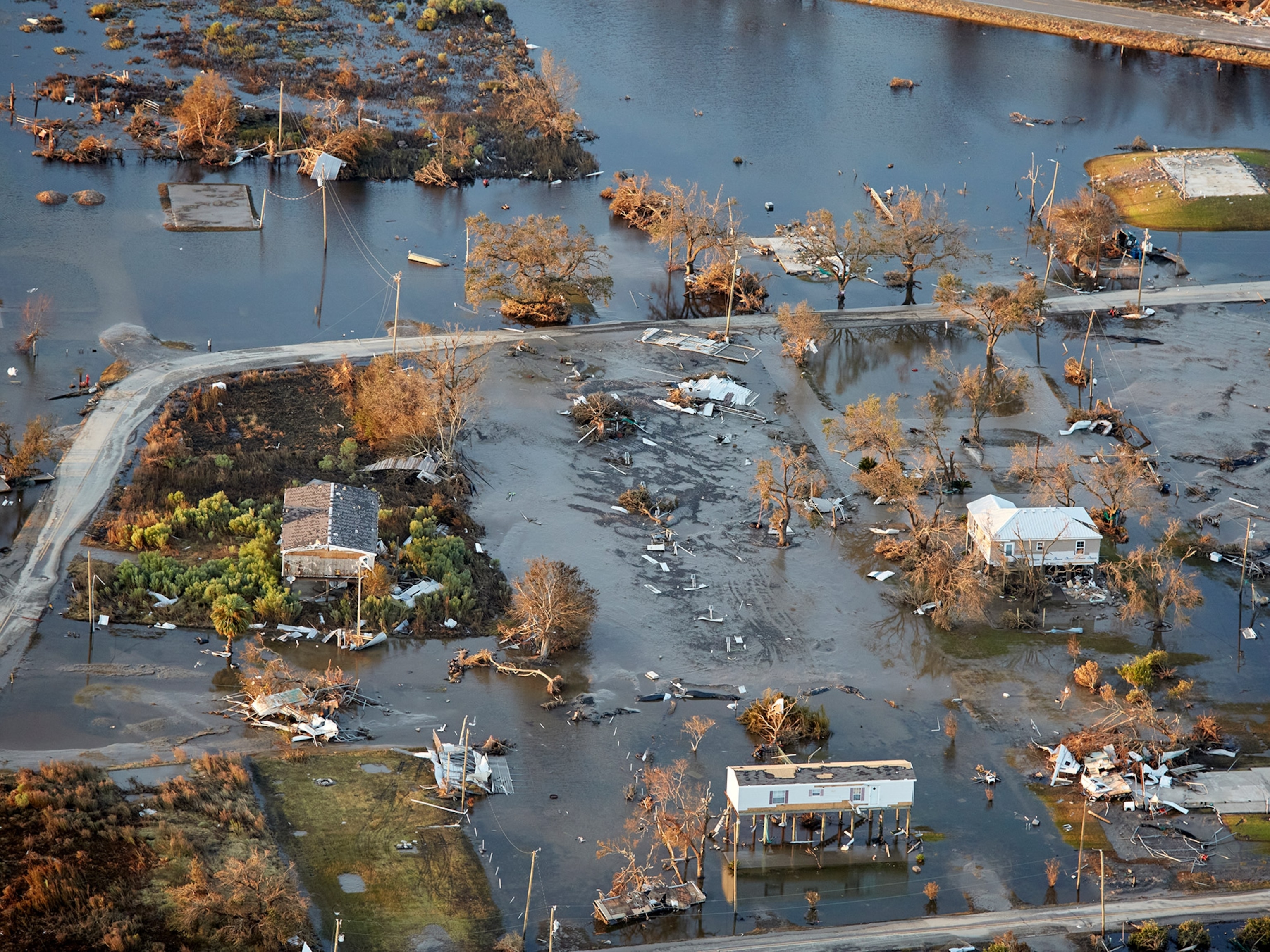
In North America the impetus for forecasting was savage weather, such as a storm that damaged a house of worship in Connecticut and inspired a sermon titled "God Sometimes Answers His People by Terrible Things in Righteousness: A Discourse Occasioned by that Awful ThunderClap Which Struck the Meeting-House in N. London, August 31st 1735." The United States, with its vast landmass and range of climates and terrain, suffers from hailstorms, blizzards, flash floods, and the world's highest incidence of tornadoes—492 of them in May 2004 alone. Fifty million people live in coastal counties prone to hurricanes. Accurate forecasting can mean the difference between prosperity and ruin, life and death.
To predict what the weather will be, you need to know what it is right now—what meteorologists call current conditions. This is one of meteorology's toughest tasks. At weather stations like the Mount Washington Observatory, at 6,288 feet (1,917 meters) on the highest peak in New Hampshire's White Mountains, current conditions are observed the old-fashioned way: by going out into them.
Guidebooks like to call Mount Washington "home of the world's worst weather," and the boast seemed plausible one winter night. The wind was peaking above 90 miles per hour (150 kilometers per hour)—hurricane force. Chunks of rime ice were crashing against the observatory windows. Steve Bailey, one of the weather observers, suited up, hung a small flashlight around his neck, and picked up an empty precipitation can—a hip-tall metal cylinder for catching rain or, tonight, snow.
He was setting off to collect and replace another can that had been out in the weather for six hours, a hundred yards from the observatory on the ice-clad mountaintop. "If the winds equal your weight, they can knock you down," he said, laughing. "I'm going to run."
I took off after him, and—wham! The wind stopped me dead. It felt like solid air. Bailey's flashlight was a glowworm, somewhere ahead in the dark, but by now he had switched cans and was running back, hugging the other cylinder.
Indoors, with boots, coat, mittens, and goggles off, he picked up his slide rule. "There's a lot of talking to yourself in this job. Dew point of 23.4 converts to what in Celsius? Height of cloud above station…7,000 to 8,000 feet (2,137 to 2,438 meters)…air pressure…three point one…patchy cloud cover…high today was 29.9…depth of snow on the ground that's a real guess."
After 15 minutes, Bailey was ready to send his report—this extraordinary weather compressed into code and numbers—to the National Weather Service. He turned to the monitor and typed in a data string.
The modem twittered.
The dispatch from Mount Washington joined the blizzard of data that descends each day on the National Centers for Environmental Prediction (NCEP), nine forecasting offices that come under the umbrella, so to speak, of the National Weather Service. (Europe also combines some meteorological efforts, at the European Centre for Medium-Range Weather Forecasts outside London, which specializes in forecasts that look ahead from two days to more than a week.)
Each day the NWS takes in 192,000 observations from surface stations, 2,700 observations from ships, 18,000 from weather buoys, 115,000 from aircraft, about 250,000 from balloons, and 140 million from satellites. Other data, in countless bytes, arrive from instrument networks abroad. Yet all this isn't enough.
The computer models that are the mainstay of current forecasting require even more data, in tidier form: readings from points on a uniform grid extending around the globe and up into the atmosphere, updated every hour or, better, every minute. That's unattainable in the real world. Satellites have trouble seeing through thick clouds and can't map winds in detail. Weather stations, balloons, aircraft, and ships aren't evenly spaced around the globe, and in many areas—vast swaths of poorer continents such as Africa—ground readings are sparse.
To fill out those observations and create a perfect starting point, meteorologists take their best recent picture of the atmosphere and project it forward in time. The result is a "forecast" of the present, which helps fill the data gaps, completing a snapshot of the current weather at every point on the imaginary global grid. It's generated with the same computer tools that allow meteorologists to look into the futurean approach called numerical modeling.
The time machine is a computer model of the atmosphere, built not from air and water vapor but from data and equations. The equations describe the key processes that govern weather, such as airflow, evaporation, Earth's rotation, and the release of heat as water condenses or freezes. When meteorologists plug in data on atmospheric conditions, then run the equations, the model predicts how the atmosphere will evolve. It lets forecasters ask: If this is what the atmosphere is doing now, what will it be doing in one minute? And then again one minute after that?
"You keep taking these baby steps forward in time," solving and re-solving the equations, explains James Hoke, director of NCEP's Hydrometeorological Prediction Center, which does the nation's general-purpose forecasting. At each step, the model computes weather conditions at all points on that imaginary global grid. The process lets meteorologists generate a full picture of current conditions, then carry it forward in time to create a forecast. Some models push as far as 16 days into the future, though by that point the accuracy is so diluted that about all they can say is whether the temperature will be above or below the normal monthly average.


Even baby-stepping into the future takes bruteforce computing. "We've always known what equations we should use," says Stacy Stewart of the National Hurricane Center in Miami. But early computers couldn't run a model fast enough for useful predictions. "You'd get forecasts three days after you needed them."
NCEP's computer center in Gaithersburg, Maryland, now crunches numbers in one of the most powerful weather-forecasting engines in the world, a supercomputer called Blue. (A backup, housed elsewhere, is called White, and researchers refine their models on a third machine called Red.) Resembling a warehouse filled with high-tech filing cabinets, the new machine isn't running at full speed yet. But by 2009 it will handle 8.6 trillion calculations—15,000 years' work with a handheld calculator—in a second.
Yet even the most sophisticated computer models drastically simplify the real atmosphere. Most track conditions at points tens of miles apart, even though actual weather can vary widely within only a couple of miles (three kilometers)—the size of a thunderstorm. The models also have biases: Some do better with hurricanes, while others are better at predicting winter weather, such as ice storms. Forecasters try to compensate by consulting different models, like patients getting second opinions. All that means extra number crunching.
Something called the butterfly effect adds to the burden. In 1972 Ed Lorenz, a meteorologist at MIT, used the atmosphere to illustrate chaos theory—the idea that tiny fluctuations can, over time, have outsize effects. He suggested that the gentlest breeze from a butterfly closing its wings on one side of the planet could cause a storm on the other. It's an exaggeration, with a measure of truth: Factors so small that they get lost—in measurement gaps or errors, or in the models' shortcuts—can make a major difference in the weather.
A small wind shift, for example, might send a storm veering miles from its predicted course. In winter "a difference of a fraction of a degree can make all the difference in the world as to whether you get all rain, or all snow, or freezing rain, or sleet," Hoke says. "That small difference has a huge impact on millions of people."
To address the butterfly effect, forecasters rely on a strategy called ensemble forecasting. Starting with one basic set of initial conditions, they run multiple forecasts—as many as 50 at the European Centre for Medium-Range Weather Forecasts, the world leader in ensemble forecasting. Each begins with a slightly different "perturbation"—a change of a mile an hour in wind, a degree in temperature, a percentage point in humidity. The forecast becomes statistical: In, say, 43 of the 50 computer runs snow develops, while in seven it rains. That's why so many forecasts use words such as "possible" or "likely," and speak of the percentage probability of precipitation.
Computers don't have the last word. After the models have their say, their output is converted to user-friendly graphics and, in the U.S., sent to the Hydrometeorological Prediction Center (HPC), on the fourth floor of a nondescript building in Camp Springs, Maryland. There flesh-and-blood meteorologists second-guess the machines.
One fall day Bruce Terry was the lead forecaster on duty, sitting at a workstation flanked by computer screens. The windows were shaded to keep out glare, hiding the weather outside. All the action was on the screens. On one a radar readout showed a blue-green smear curving up from the southern plains states toward the Ohio Valley; another displayed a satellite view of the same region, veiled in gray cloud. On that particular day Terry's job was to decide where the rain would fall, and how much. Forecasting precipitation, he said, is one of his greatest challenges.
At least it wasn't summer, when thunderstorms, too small for the computer models to capture, deliver most of the rain. "You'll have an inch (2.5 centimeters) of rain here, but five miles (eight kilometers) down the road you get nothing," said Terry. Precipitation forecasts are easier in the cool seasons, when weather systems tend to be large and well organized, like this one.
He stared at the screen some more. "It's really important to be able to recognize the biases in the models," he said. Right now, comparing the rain on the screen with model forecasts, Terry sensed a bias was at work. "In the first six hours of the forecast, the models never seem to have enough precipitation." His experience told him this storm system was ripe for heavy rain. A patch of low pressure was lingering over the southern Rockies, drawing wet air from the Gulf of Mexico and supercharging the storm with moisture.
The computer had given him its best guess, but now it was time to follow his instincts. He frowned and used his computer drafting tool to sketch in corrected precipitation estimates, calling for heavier rain. By morning, he forecast, the core of the storm would be drenching Washington, D.C., and the leading edge would be over New England, promising snow. The next day, commuters would find he was right.
"You noticed Bruce was bald?" his colleague Pete Manousos joked. "He pulls his hair out when he does his forecasts."
In fact, what the HPC staff such as Bruce Terry produce is not, officially, a forecast, but "guidance" or "advice" for the 125 local NWS Weather Forecast Offices. It's also grist for commercial forecasters—purveyors of weather "products" such as glossy maps and satellite images for radio, newspapers, TV, and websites. Some even sell specialized forecasts to windsurfers wondering which beach has the best conditions, or to orchid growers needing advance warning of frost.
Other forecasters are looking beyond weather to its ripple effects on the infrastructure, environment, and economy. Pilot projects in several states combine winter storm forecasts with data on roads and traffic to help highway departments dispatch the right number of plows and salt trucks to the right highways at the right time. And in Florida, researchers are turning weather prediction into forecasts of fire.
In a conference center at Florida State University, two dozen meteorologists, computer modelers, and foresters lean forward in excitement as Phil Cunningham, a meteorology professor at the university, starts a video. The screen shows a small wildfire nibbling at a Florida woodland. Low flames blacken palmetto and gallberry undergrowth, and a few trees smoke.
Within seconds the smoke pall starts to rotate. Suddenly the flames at the center seem to twist together, then leap upward. An astounding thing is growing, a "fire whirl" that spirals above the treetops, tight and vivid as a tornado.
Wildfires are a major threat to the sprawling suburbs of Florida, where land once cleared for crops now grows scrub and trees, and in the subtropical climate grows them very efficiently. "I've seen trees put on five feet (1.5 meters) in a year," says Gary Achtemeier, a Forest Service research meteorologist. A long dry spell between December and May, followed by the most intense lightning season in the mainland U.S., adds to the danger.
Deliberate fires, called prescribed burns, can reduce the risk, but only if the weather is right. hot winds can send the fire spiraling out of control. Calm weather is better-except when a temperature inversion traps the smoke at ground level. Then it can mix with water vapor to form a lethal "superfog" that can steal along low drainages and throw a curtain across a highway."
Typically these superfogs develop when there's a clear sky, light winds, and unlimited visibility. People are driving 60, 70 miles an hour (97, 113 kilometers an hour), and they come into one of these drainages, and"-Achtemeier snaps his fingers-"they can't see beyond the hood of their car."
So Cunningham is combining weather forecasts with computer simulations of fire to predict how a prescribed burn might behave. That's not simple, because fire makes its own weather. The fire's updraft, for example, sucks in air and generates winds that fan the flames. But the researchers hope to create a tool for telling foresters where and when to burn, and how the smoke will spread. "In five to eight years," says Al Riebau, the Forest Service's national program leader for atmospheric sciences, "parents of asthmatic children may be able to check on their laptops to see if any smoke is going to be heading their way."
And what's the forecast for forecasting ordinary weather—the cold fronts, drizzle, and sunshine that are the backdrop to most people's lives? Steady improvement, says Richard Anthes, president of the University Corporation for Atmospheric Research in Boulder. By 2025, he says, "numerical predictions in the zero to two-day time frame will be essentially perfect. If the forecast says 12 inches (30.5 centimeters) of snow, the actual amount will be in the 10- to 14-inch (28- to 33-centimeter) range." Forecasts of temperatures and storms a week out will be as reliable as two- to three-day forecasts are today-which is to say, right most of the time.
More detailed models and faster computers will drive some progress. Computing-intensive pilot projects in some major U.S. cities, for example, are already forecasting thunderstorms up to 24 hours ahead, to within a couple of miles-useful for airports, though not good enough to guarantee a storm-free picnic or wedding. But better data will be the real key, say meteorologists.
New generations of satellites will help fill the gaps that now hamper forecasts. Starting in December, if plans hold, a joint U.S-Taiwan system called FORMOSAT-3/COSMIC will probe the atmosphere by eavesdropping on radio signals from the global positioning system's satellite beacons. The six COSMIC satellites will pick up GPS signals that have passed into the atmosphere and back out to space. By analyzing how air temperature and moisture affect the speed of the radio waves, COSMIC will create a global map of these atmospheric properties.
Other satellites will sample the atmosphere with light. A technology called LIDAR (an acronym for "light detection and ranging") works like a light-based radar gun, clocking wind by sending out a laser pulse and catching its reflections from air molecules and dust particles. A satelliteborne LIDAR could track winds over the oceans, where measurements are patchy—and where hurricanes and typhoons begin their march to shore.
"If you can cut the uncertainty in the predicted landfall site of a hurricane to a hundred kilometers [60 miles]," says Jim Ryan, a physicist at the University of New Hampshire who is developing a LIDAR, "you can start talking about more intelligent evacuations, instead of sounding alarms over half the eastern seaboard." Next year Ryan hopes to launch a balloon-mounted LIDAR—a first step toward a satellite version.
Near the foot of Mount Washington one frigid New Hampshire night, as the last blush of sunset silhouetted the birches, Ryan supervised a LIDAR test. Inside the small, domed observatory an operator threw a switch, and a brilliant pale green line leaped up into the dark sky. Whenever a fleck of dust drifted into the beam, it seemed to spark.
Every few seconds the laser fell dark, then lit up again—the finger of meteorology probing the heavens over and over.
Related Topics
You May Also Like


Go Further
Animals
- This ‘saber-toothed’ salmon wasn’t quite what we thoughtThis ‘saber-toothed’ salmon wasn’t quite what we thought
- Why this rhino-zebra friendship makes perfect senseWhy this rhino-zebra friendship makes perfect sense
- When did bioluminescence evolve? It’s older than we thought.When did bioluminescence evolve? It’s older than we thought.
- Soy, skim … spider. Are any of these technically milk?Soy, skim … spider. Are any of these technically milk?
- This pristine piece of the Amazon shows nature’s resilienceThis pristine piece of the Amazon shows nature’s resilience
Environment
- This pristine piece of the Amazon shows nature’s resilienceThis pristine piece of the Amazon shows nature’s resilience
- Listen to 30 years of climate change transformed into haunting musicListen to 30 years of climate change transformed into haunting music
- This ancient society tried to stop El Niño—with child sacrificeThis ancient society tried to stop El Niño—with child sacrifice
- U.S. plans to clean its drinking water. What does that mean?U.S. plans to clean its drinking water. What does that mean?
History & Culture
- Séances at the White House? Why these first ladies turned to the occultSéances at the White House? Why these first ladies turned to the occult
- Gambling is everywhere now. When is that a problem?Gambling is everywhere now. When is that a problem?
- Beauty is pain—at least it was in 17th-century SpainBeauty is pain—at least it was in 17th-century Spain
- The real spies who inspired ‘The Ministry of Ungentlemanly Warfare’The real spies who inspired ‘The Ministry of Ungentlemanly Warfare’
- Heard of Zoroastrianism? The religion still has fervent followersHeard of Zoroastrianism? The religion still has fervent followers
Science
- Here's how astronomers found one of the rarest phenomenons in spaceHere's how astronomers found one of the rarest phenomenons in space
- Not an extrovert or introvert? There’s a word for that.Not an extrovert or introvert? There’s a word for that.
- NASA has a plan to clean up space junk—but is going green enough?NASA has a plan to clean up space junk—but is going green enough?
- Soy, skim … spider. Are any of these technically milk?Soy, skim … spider. Are any of these technically milk?
- Can aspirin help protect against colorectal cancers?Can aspirin help protect against colorectal cancers?
Travel
- What it's like to hike the Camino del Mayab in MexicoWhat it's like to hike the Camino del Mayab in Mexico
- Is this small English town Yorkshire's culinary capital?Is this small English town Yorkshire's culinary capital?
- This chef is taking Indian cuisine in a bold new directionThis chef is taking Indian cuisine in a bold new direction
- Follow in the footsteps of Robin Hood in Sherwood ForestFollow in the footsteps of Robin Hood in Sherwood Forest
